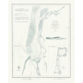
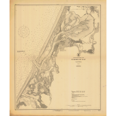
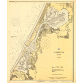
This chart is made from a scan of an actual historic chart and is presented as the original with all of the marks, tears and stains.
- Printed on heavy-duty paper
- Custom sizing available. Contact us for more info
- Comes rolled a a cardboard tube
- Suitable for framing
Our collection of historical charts is gathered from historicalcharts.noaa.gov. Office of Coast Survey's Historical Map & Chart Collection covers the land and waters of the United States of America, including territories and possessions (past and present).
Today's Office of Coast Survey traces its charting efforts back to 1807, when President Thomas Jefferson founded the Survey of the Coast. To celebrate and preserve this long history, NOAA started assembling the collection in 1995 as a data rescue effort. NOAA continues to preserve charts and maps produced by NOAA's Coast Survey and its predecessors, especially the U.S. Coast and Geodetic Survey and the U.S. Lake Survey (previously under the Department of War).
The collection also covers many areas that most people may not realize were once a part of early Coast Survey history. As the first federal scientific agency, the U.S. Coast and Geodetic Survey (as the agency was known from 1878 to 1970) produced land sketches, Civil War battle maps, and aeronautical charting from the 1930s to the 1950s.
Notice: Historical Charts are not for Navigation. Screen captures of Historical Charts do not fulfill chart carriage requirements for regulated commercial vessels under Titles 33 and 46 of the Code of Federal Regulations.
