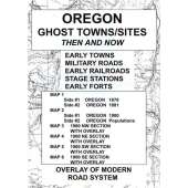
Utah Ghost Towns/Sites: Then and Now is a package, measuring 6.5″ x 9″, containing six maps of the state of Utah. The very readable maps (measuring 18″ x 24″ unfolded) were selected for quality, age and location details. This package includes:
Map #1, side 1 Utah 1876. Side 2 Utah 1889
Map #2, side 1 Utah 1900. Side 2 Utah populations
Map #3, side 1 Utah 1900 northwest section with overlay. Side 2 is text
Map #4, side 1 Utah 1900 northeast section with overlay. Side 2 is text
Map #5, side 1 Utah 1900 southwest section with overlay. Side 2 is text
Map #6, side 1 Utah 1900 southeast section with overlay. Side 2 is text
