



NOAA stopped making its traditional numbered paper charts. The last one was archived on December 5, 2024, at the end of NOAA's raster chart sunset. What replaced them is the NOAA Custom Chart, or NCC: a chart drawn from the latest official NOAA electronic navigational chart (ENC) data for whatever area and scale you choose. We built our Chart Maker Tool so you can lay one out on our site and have us print it, without learning NOAA's own application first.
These are official NOAA Custom Charts, created directly from the latest official NOAA electronic navigational chart (NOAA ENC®) data. On its Custom Charts page, NOAA says that all recreational and professional mariners are encouraged to use the electronic navigational chart (ENC) for their primary means of navigation. NOAA also says that NCC uses the latest up-to-date NOAA ENC data to create customized charts, and that these charts are especially useful for voyage planning and situational awareness.
Two tabs
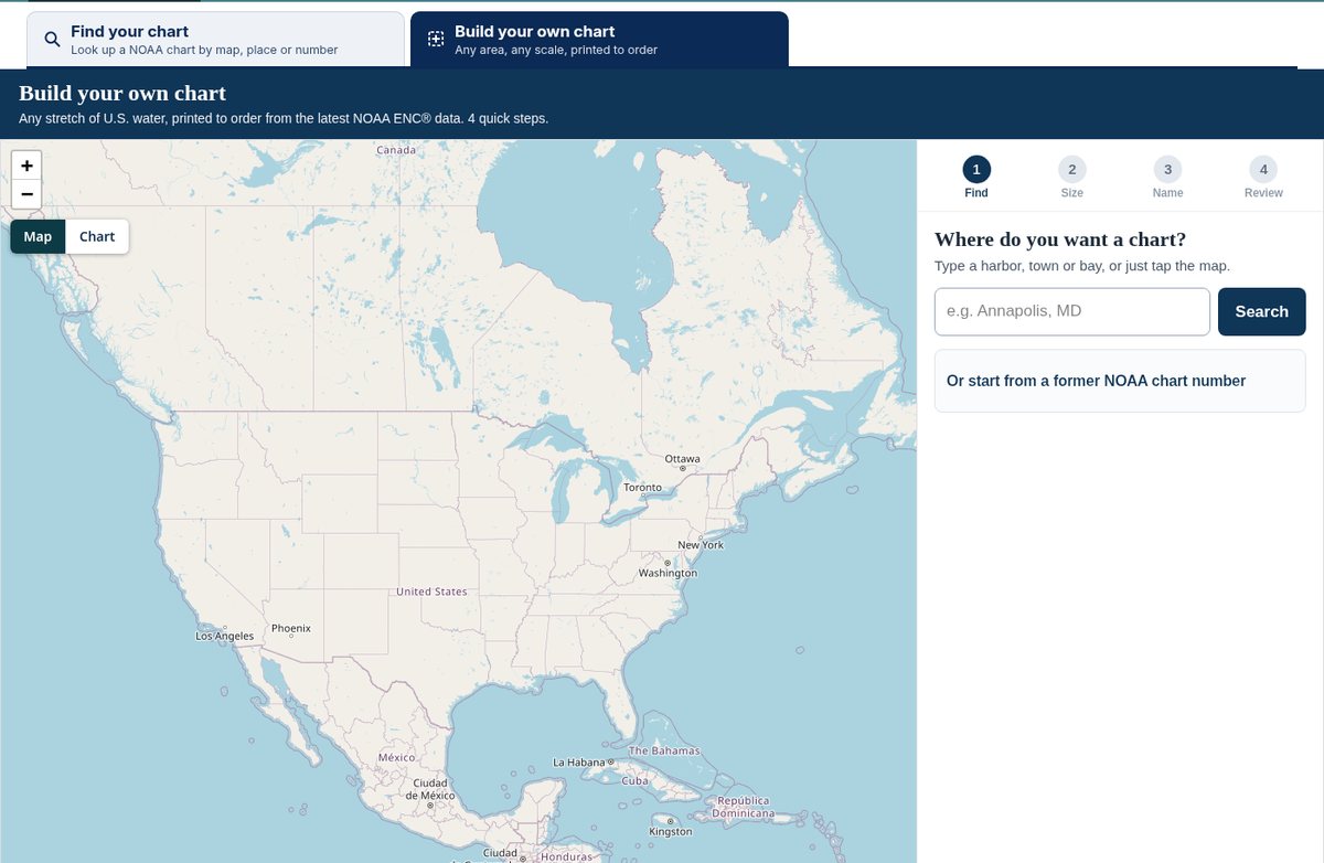
The Chart Maker Tool opens with two tabs. Find your chart is a map of NOAA chart outlines. Click the map, search a harbor or town, or type a chart number, and it shows the charts that cover that spot, filtered by harbor, coastal, general or sailing scale if you like. Build your own chart is where you lay out a new NCC.
Building a chart
Start by typing a harbor, town or bay, or tap the map where you want the chart centered. If you used to carry a numbered NOAA chart, type its old number (12327, for example) and the tool sets up the same area and scale for you.
Next pick a sheet size. A blue box on the map shows what the chart will cover, and a slider runs from close-up, with more detail, to a wider area. There are a few more settings that most people skip: turn the sheet sideways for landscape or keep it upright, show depths in feet, fathoms or meters, choose four depth shades or two, or type an exact scale.
Then name it. The tool suggests a name from the nearby places and the center latitude and longitude. Keep it or type your own, up to 60 characters, and it prints across the top of the chart.
The last step is the review. You see a preview drawn from NOAA chart data for exactly that area, pick paper or waterproof, and check the box to confirm the order. The preview is approximate. The printed chart is made fresh from the latest official NOAA ENC data on the day we print it, with a full border, title, scale, latitude and longitude, and the print date, so lettering and symbols will look a little different from the screen.
Two things trigger a warning before you order. One is a box that runs outside NOAA's chart data, where that part would print blank or as plain land. The other is a closer view than the data supports, which enlarges the chart and makes it look sparse. You can move or resize the box, or tick the box and order it anyway.
Sizes, materials and what happens after you order
There are three sizes. Small is 17 by 22 inches, $14.95 on paper or waterproof. Full size is 36 by 48 inches, $24.95 on paper or $28.95 waterproof. Large is 42 by 60 inches on paper for $32.95.
Our paper is a heavyweight, water-resistant chart paper. The waterproof material is very tear resistant and takes pencil well and erases cleanly. If you plan to frame or laminate a chart with heat, choose paper, because the waterproof material can melt.
After checkout we create your chart from the latest official NOAA ENC data, usually within minutes, and check it before it goes to the printer. If our check turns up a problem, we fix it or contact you first. Printing and shipping then run on our normal chart times. You can build several charts and put them all in one order. Each one prints from its own settings and the whole order ships together.
A custom chart is a single panel with no insets, and the date of the NOAA data is printed on it. It does not include Notices to Mariners issued after that date. NOAA Custom Charts do not have identifying chart numbers, and U.S. Coast Guard Local Notices to Mariners are not issued for these charts. Because each one is printed to order, custom charts can't be returned. If one arrives damaged or misprinted, contact us and we will make it right.

Already made an NCC?
If you built a chart in NOAA's own NCC application, download the PDF and order it on our NOAA Custom Chart (NCC) Printing page, where you choose the material and size and upload the file. You can also send us a former NOAA chart number and we will make an NCC covering that area. The scale and insets may differ from the old chart. Our page on NOAA Custom Charts explains more about how they differ from the old charts, and all of our NOAA charts are in one collection.