



Best Sellers
Our best-selling charts, books and guides right now.
Our best-selling charts, books and guides right now.


NOAA Chart 18704: San Luis Obispo Bay: Port San Luis

CHS Chart 7565: Clyde Inlet to/à Cape Jameson

Backyard Foraging: 65 Familiar Plants You Didn't Know You Could Eat - Book

Weems & Plath: The Maintenance Log - Book

NGA Chart 27184: Punta Colorado to Jucaro

Nature's Best Hope: A New Approach to Conservation That Starts in Your Yard - Book

CHS Chart 3727: Cape Calvert to Goose Island including Fitz Hugh Sound

CHS Chart 7920: Tanquary,Slidee and Glacier Fiords


HISTORICAL NOAA Chart 18535: Columbia River John Day Dam to Blalock


NOAA Chart 11531: Winyah Bay to Bulls Bay

CHS Chart 3939: Fisher Channel to/à Seaforth Channel and/et Dean Channel

Sea Turtles of the Atlantic & Gulf of Mexico - Folding Pocket Guide


HISTORICAL NOAA Chart 11553: Intracoastal Waterway Albermarle Sound to Neuse River;Alligator River;Second Creek


Hawaii Seashore Life - Folding Pocket Guide

Explorer's Guide 50 Hikes in Utah - Book

NGA Chart 29121: Brabant Island to Deception Island


NOAA Chart 11513: St. Helena Sound to Savannah River

NGA Chart 26257: Plans In the Bahamas - Highbourn Cut

CHS Chart 3497: Vancouver Harbour Central Portion/Partie Centrale


The Creaky Knees Guide Washington, 3rd Edition: The 100 Best Easy Hikes - Book

Intracoastal Waterway CHARTBOOK, 6th edition: Norfolk to Miami - Book

NGA Chart 21560: Punta Guiones to Punta Burica

The State of Fire: Why California Burns - Book

Stark Tables for Clearing the Lunar Distance - Book

Butterflies & Pollinators: A Folding Pocket Guide to Familiar Species - Folding Pocket Guide


NOAA Chart 16535: Morzhovoi Bay and Isanotski Strait
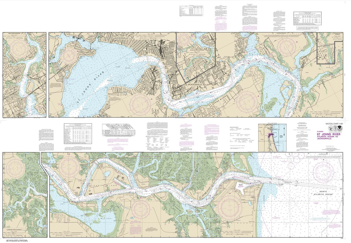

HISTORICAL NOAA Chart 11491: St. Johns River-Atlantic Ocean to Jacksonville

CHS Chart 2018: Lower Gap to/à Adolphus Reach


NOAA Chart 17303: Yakobi Island and Lisianski Inlet;Pelican Harbor

Oh Say Can You Seed?: All About Flowering Plants - Book


NOAA Chart 11409: Anclote Keys to Crystal River

CHS Chart 5476: Harbours and Anchorages Hudson Bay and James Bay/Ports et Mouillages Baie d'Hudson et Baie James...

CHS Chart 6438: Peel River, Mackenzie River/Fleuve Mackenzie to/à Road Island


HISTORICAL NOAA Chart 11385: Intracoastal Waterway West Bay to Santa Rosa Sound

Best Dog Hikes Northern California - Book

CHS Chart 3496 - Approaches to/Approches à Vancouver Harbour


NOAA Chart 17428: Revillagigedo Channel: Nichols Passage: and Tongass Narrows;Seal Cove;Ward Cove


Don't Make it Weird Squatch - Vinyl Sticker

Bigfoot With Wine Glass And Bottle - Magnet


The Creaky Knees Guide Oregon, 3rd Edition: The 85 Best Easy Hikes - Book


Edible Wild Plants - Folding Pocket Guide

NGA Chart 21550: Cabo Velas to Cabo Blanco Costa Rica

CHS Chart 3540: Approaches to/Approches à Campbell River


NOAA Chart 11301: Southern part of Laguna Madre


NOAA Chart 17324: Sitka Sound to Salisbury Sound: Inside Passage;Neva Str.-Neva Pt. to Zeal Pt.

Ro-Ro Handbook : A Practical Guide to Roll-On Roll-Off Cargo Ships - Book


Saltwater Fishes 2nd Ed. - Folding Pocket Guide

Coyote at the Big Time: A California Indian 123 - Board Book

CHS Chart 6273: North Manitou Island to/à Whiskey Jack Island

CHS Chart 6249: Gull Harbour to/à Riverton

CHS Chart 2017: Kingston Harbour and Approaches/et les approches


Mushrooms - A Folding Pocket Guide to Familiar North American Species - Laminated Pocket Guide

NGA Chart 14024: Island of Newfoundland


California Butterflies & Pollinators: A Folding Pocket Guide to Familiar Species - Folding Pocket Guide


NOAA Chart 18022: San Diego to San Francisco Bay


NOAA Chart 16532: Akutan Bay: Krenitzin Islands

Tidal Havens of the Wash and Humber, 6th edition (Imray) - Book


NOAA Chart 11340: Mississippi River to Galveston

There's No Place Like Space!: All About Our Solar System - Book


NOAA Chart 11408: Crystal River to Horseshoe Point;Suwannee River;Cedar Keys

CHS Chart 2302: St. Ignace Island to/à Passage Island


NOAA Chart 17302: Icy Strait and Cross Sound;Inian Cove;Elfin Cove

What the Robin Knows: How Birds Reveal the Secrets of the Natural World - Book

Hiking with Kids Idaho: 50 Great Hikes for Families - Book


NOAA Chart 11490: Approaches to St. Johns River;St. Johns River Entrance

National Geographic Readers: Coral Reefs - Book


NOAA Chart 11512: Savannah River and Wassaw Sound

CHS Chart 5471: Inukjuak et les Approches and Approaches

Magic Tree House Fact Tracker: Rain Forests - Book


Richard Scarry's Cars and Trucks and Things That Go: 50th Anniversary Edition - Book


NOAA Chart 11384: Pensacola Bay Entrance

CHS Chart 3495: Vancouver Harbour Eastern Portion/Partie Est


Nature of San Francisco & the Bay Area - Folding Pocket Guide

CHS Chart 2267: Great Duck Island to/à False Detour Passage


NOAA Chart 11300: Galveston to Rio Grande

The Coasts of California: A California Field Atlas - Book

NGA Chart 21547: San Juan del Sur and Approaches


Bigfoot Redwood Tree Shape Decorative Wind Spinner, Rainbow Colored Stainless Steel

Peterson Field Guide Coloring Books: Birds - Book

Leave Only Footprints Beach - Vinyl Sticker

The Weekend Navigator 2nd Edition - Book


NOAA Chart 16603: Kukak Bay: Alaska Peninsula

CHS Chart 6437: Peel Channel including/y compris Husky Channel and /et Phillips Channel


NOAA Chart 17323: Salisbury Sound: Peril Strait and Hoonah Sound

CHS Chart 2016: Charity Shoal to/à Gull Bar including / y compris Long Point


NOAA Chart 17427: Portland Canal - Dixon Entrance to Hattie I.

NGA Chart 14018: Grand Banks of Newfoundland

Spiders: A Folding Pocket Guide to Familiar Species Worldwide - Folding Pocket Guide

Master's Handbook on Ship's Business, 4th Ed. - Book

Atlantic France:North Biscay to the Spanish border, 1st edition (Imray) - Book

CHS Chart 2077: Lake Ontario/Lac Ontario (Western Portion/Partie Ouest)

Wild Ocean: Sharks, Whales, Rays, and Other Endangered Sea Creatures - Book


NOAA Chart 11407: Horseshoe Point to Rock Islands;Horseshoe Beach


Saltwater Fishing Essentials: A Folding Pocket Guide to Gear, Techniques & Useful Tips - Folding Pocket Guide

NGA Chart 26308: Tongue of the Ocean - Northern Part


HISTORICAL NOAA Chart 11339: Calcasieu River and Approaches

CHS Chart 6248: Observation Point to/à Grindstone Point

CHS Chart 6272: Red Deer Point to/à North Manitou Island
State Of Alaska W/ Dungeness Crab - Keychain


NOAA Chart 18020: San Diego to Cape Mendocino

Best Easy Day Hikes Bend and Central Oregon - Book


NOAA Chart 11511: Ossabaw and St. Catherines Sounds


NOAA Chart 17301: Cape Spencer to Icy Point

Seaside Heart Starfish Sand Dollar MAGNET


HISTORICAL NOAA Chart 11489: Intracoastal Waterway St. Simons Sound to Tolomato River

CHS Chart 2301: Passage Island to/à Thunder Bay


Home for a Bunny: A Classic Bunny Book for Kids - Book

Fish Eyes: A Book You Can Count On - Book

Essential Muir (Revised): A Selection of John Muir’s Best (and Worst) Writings - Book

CHS Chart 5861: Ship Sands Island to/à Moosonee

CHS Chart 3493: Vancouver Harbour Western Portion/Partie Ouest

NGA Chart 21546: Puntarenas and Puerto Caldera

CHS Chart 7050: Resolution Island to/à Cape Mercy

Inland Waterways of the Netherlands 2ND ED - Book


NOAA Chart 16601: Cape Alitak to Cape lkolik

CHS Chart 2266: Michael's Bay to/à Great Duck Island


NOAA Chart 17322: Khaz Bay: Chichagof Island Elbow Passage


Mushrooms of Cascadia, Second Edition: An Illustrated Key to the Fungi of the Pacific Northwest - Book

Day Hikes Around Big Sur: 99 Great Hikes - Book

NGA Chart 14003: Cape Henry to Cape Race

CHS Chart 3538: Desolation Sound and/et Sutil Channel

CHS Chart 6436: Napoiak Channel, including / y compris Schooner and/et Taylor Channels Kilometre/Kilomètre 1590 ...


NOAA Chart 1117A: Galveston to Rio Grande (Oil and Gas Leasing Areas)

Owls: A Folding Pocket Guide to Familiar Species Worldwide - Folding Pocket Guide


NOAA Chart 11406: St.Marks River and approaches


Southern Night Sky - Folding Pocket Guide

NGA Chart 26247: Entrance Channel to Bahia de Banes

CHS Chart 2070: Harbours in Lake Ontario/Havres dans le lac Ontario

CHS Chart 6271: Winnipegosis to/à Red Deer Point


NOAA Chart 17426: Kasaan Bay: Clarence Strait;Hollis Anchorage: eastern part;Lyman Anchorage


Basic First Aid for Non-Medical First Responders and SAR Volunteers - Folding Pocket Guide

Backyard Bugs: 101 Flashcards for Discovering Insects

The Last Stand of the Tin Can Sailors: The Extraordinary World War II Story of the U.S. Navy's Finest Hour - Book


NOAA Chart 11510: Sapelo and Doboy Sounds
State Of New Hampshire W/ Bigfoot - Magnet

Great Walks: Acadia National Park & Mount Desert Island - Book


HISTORICAL NOAA Chart 11319: Intracoastal Waterway Cedar Lakes to Espiritu Santo Bay

CHS Chart 6247: Wightman Point to/à Whiskey Jack Portage

CHS Chart 2300: Lake Superior/Lac Supérieur


NOAA Chart 16580: Kodiak Island;Southwest Anchorage: Chirikof Island


NOAA Chart 18010: Monterey Bay to Coos Bay


HISTORICAL NOAA Chart 11488: Amelia Island to St. Augustine

How to Play in the Woods: Activities, Survival Skills, and Games for All Ages - Book


