



Navigational Charts
Paradise Cay Publications is listed by NOAA as a NOAA Custom Chart (NCC) printing vendor.

Paradise Cay Publications is listed by NOAA as a NOAA Custom Chart (NCC) printing vendor.

FAA Chart: North Pacific Route Chart Composite FLAT

FAA Chart: North Pacific Route Chart Northeast FLAT

FAA Chart: North Pacific Route Chart Northwest FLAT

FAA Chart: North Pacific Route Chart Set FLAT

FAA Chart: North Pacific Route Chart Southeast FLAT

FAA Chart: North Pacific Route Chart Southwest FLAT

FAA Chart: VFR TAC PUERTO RICO & VIRGIN ISLANDS

FAA Chart: U.S. GULF COAST VFR Aeronautical Chart


FAA Chart: VFR Helicopter BALTIMORE/WASHINGTON


FAA Chart: VFR Helicopter DALLAS/FT WORTH


FAA Chart: VFR Sectional JUNEAU/WHITEHORSE


FAA Chart: VFR Sectional WESTERN ALEUTIAN ISLANDS


Florida FAA Stitched Sectional Chart - Poster

Florida Keys Chart Atlas (12x18 Spiral-bound)


Georgia FAA Stitched Sectional Chart - Poster

Great Lakes Chart Atlas (Lake Michigan, Lake Superior & Lake Erie) 12x18 Spiral-bound

Gulf Coast Texas to Mississippi Chart Atlas (12x18 Spiral-Bound)


Hawaii FAA Stitched Sectional Chart - Poster

Hawaiian Islands Chart Atlas (12x18 Spiral-Bound)

Historical Chart: Cape Mendocino to Point St. George 1891 (36 x 50 inches)

Historical Chart: Gold Region in California 1851 (21 x 27 inches)

Historical Chart: Humboldt Bay 1852 (21 x 26 inches)

Historical Chart: Humboldt Bay 1894 (29 x 36 inches)

Historical Chart: Humboldt Bay 1916 (36 x 43 inches)

Historical Chart: Humboldt Bay 1921 (36 x 43 inches)

Historical Chart: Little River Rock to Rocky Point 1874 (25x42)

Historical Chart: Oregon Territory 1841 (36 x 25 inches)

Historical Chart: Shelter Cove 1881 (36x40)

Historical Chart: Trinidad Harbor 1874 (25 x 21)

HISTORICAL NOAA Booklet Chart 1113A: Havana to Tampa Bay (Oil and Gas Leasing Areas)

HISTORICAL NOAA Booklet Chart 1114A: Tampa Bay to Cape San Blas (Oil and Gas Leasing Areas)

HISTORICAL NOAA Booklet Chart 1115A: Cape St. George to Mississippi Passes (Oil and Gas Leasing Areas)

HISTORICAL NOAA Booklet Chart 1116A: Mississippi River to Galveston (Oil and Gas Leasing Areas)

HISTORICAL NOAA BookletChart 1117A: Galveston to Rio Grande (Oil and Gas Leasing Areas)


HISTORICAL NOAA BookletChart 18620: Point Arena to Trinidad Head with MARINE PROTECTED AREAS Highlighted


NOAA Chart 50: North Pacific Ocean (eastern part) Bering Sea Continuation


NOAA Chart 500: West Coast Of North America Dixon Ent To Unimak Pass


NOAA Chart 501: North Pacific Ocean West Coast Of North America Mexican Border To Dixon Entrance


NOAA Chart 530: North America West Coast San Diego to Aleutian Islands and Hawai'ian Islands


NOAA Chart 1113A: Havana to Tampa Bay (Oil and Gas Leasing Areas)


NOAA Chart 1114A: Tampa Bay to Cape San Blas (Oil and Gas Leasing Areas)


NOAA Chart 1115A: Cape St. George to Mississippi Passes (Oil and Gas Leasing Areas)


NOAA Chart 1116A: Mississippi River to Galveston (Oil and Gas Leasing Areas)


NOAA Chart 1117A: Galveston to Rio Grande (Oil and Gas Leasing Areas)


NOAA Chart 4149: Straits of Florida - Eastern Part


NOAA Chart 5161: Newport, Rhode Island to Bermuda (Plotting Sheet)


NOAA Chart 11006: Key West to Mississippi River


NOAA Chart 11013: Straits of Florida and Approaches


NOAA Chart 11300: Galveston to Rio Grande


NOAA Chart 11301: Southern part of Laguna Madre


NOAA Chart 11302: Intracoastal Waterway Stover Point to Port Brownsville: including Brazos Santiago Pass


NOAA Chart 11303: Intracoastal Waterway Laguna Madre - Chubby Island to Stover Point: including The Arroyo Colorado


NOAA Chart 11304: NORTHERN PART OF LAGUNA MADRE


HISTORICAL NOAA Chart 11306: Intracoastal Waterway Laguna Madre Middle Ground to Chubby Island


NOAA Chart 11307: Aransas Pass to Baffin Bay


HISTORICAL NOAA Chart 11308: Intracoastal Waterway Redfish Bay to Middle Ground


NOAA Chart 11311: Corpus Christi Harbor


NOAA Chart 11312: Corpus Christi Bay - Port Aransas to Port Ingleside


NOAA Chart 11313: Matagorda Light to Aransas Pass


NOAA Chart 11314: Intracoastal Waterway Carlos Bay to Redfish Bay: including Copano Bay


HISTORICAL NOAA Chart 11315: Intracoastal Waterway Espiritu Santo Bay to Carlos Bay including San Antonio Bay and Victoria Barge Canal


NOAA Chart 11316: Matagorda Bay and approaches


NOAA Chart 11317: Matagorda Bay including Lavaca and Tres Palacios Bays; Port Lavaca; Continuation of Lavaca River; Continuation of Tres Palacios Bay


HISTORICAL NOAA Chart 11319: Intracoastal Waterway Cedar Lakes to Espiritu Santo Bay


NOAA Chart 11321: San Luis Pass to East Matagorda Bay


HISTORICAL NOAA Chart 11322: Intracoastal Waterway Galveston Bay to Cedar Lakes


NOAA Chart 11323: Approaches to Galveston Bay


NOAA Chart 11324: Galveston Bay Entrance Galveston and Texas City Harbors


NOAA Chart 11325: Houston Ship Channel Carpenters Bayou to Houston


HISTORICAL NOAA Chart 11326: Galveston Bay


NOAA Chart 11327: Upper Galveston Bay-Houston Ship Channel-Dollar Pt. to Atkinson


NOAA Chart 11328: Houston Ship Channel Atkinson Island to Alexander Island


NOAA Chart 11329: Houston Ship Channel Alexander Island to Carpenters Bayou;San Jacinto and Old Rivers


NOAA Chart 11330: Mermentau River to Freeport


HISTORICAL NOAA Chart 11331: Intracoastal Waterway Ellender to Galveston Bay


NOAA Chart 11340: Mississippi River to Galveston


NOAA Chart 11341: Calcasieu Pass to Sabine Pass


NOAA Chart 11343: Sabine and Neches Rivers


NOAA Chart 11344: Rollover Bayou to Calcasieu Pass


HISTORICAL NOAA Chart 11346: Port Fourchon and Approaches


HISTORICAL NOAA Chart 11347: Calcasieu River and Lake


HISTORICAL NOAA Chart 11348: Intracoastal Waterway Forked Island to Ellender: including the Mermantau River: Grand Lake and White Lake


NOAA Chart 11349: Vermilion Bay and approaches


HISTORICAL NOAA Chart 11350: Intracoastal Waterway Wax Lake Outlet to Forked Island including Bayou Teche: Vermilion River: and Freshwater Bayou


NOAA Chart 11351: Point au Fer to Marsh Island


NOAA Chart 11353: Baptiste Collette Bayou to Mississippi River Gulf Outlet;Baptiste Collette Bayou Extension


HISTORICAL NOAA Chart 11354: Intracoastal Waterway Morgan City to Port Allen: including the Atchafalaya River


HISTORICAL NOAA Chart 11355: Intracoastal Waterway Catahoula Bay to Wax Lake Outlet including the Houma Navigation canal


NOAA Chart 11356: Isles Dernieres to Point au Fer


NOAA Chart 11357: Timbalier and Terrebonne Bays


NOAA Chart 11358: Barataria Bay and approaches


NOAA Chart 11359: Loop Deepwater Port Louisiana Offshore Oil Port


NOAA Chart 11360: Cape St. George to Mississippi Passes


NOAA Chart 11361: Mississippi River Delta;Southwest Pass;South Pass;Head of Passes


NOAA Chart 11363: Chandeleur and Breton Sounds


NOAA Chart 11364: Mississippi River-Venice to New Orleans


HISTORICAL NOAA Chart 11365: Barataria and Bayou Lafourche Waterways Intracoastal Waterway to Gulf of Mexico


NOAA Chart 11366: Approaches to Mississippi River


HISTORICAL NOAA Chart 11367: Intracoastal Waterway Waveland to Catahoula Bay


NOAA Chart 11368: New Orleans Harbor Chalmette Slip to Southport


NOAA Chart 11369: Lakes Pontchartrain and Maurepas


HISTORICAL NOAA Chart 11370: Mississippi River-New Orleans to Baton Rouge


NOAA Chart 11371: Lake Borgne and approaches Cat Island to Point aux Herbes


HISTORICAL NOAA Chart 11372: Intracoastal Waterway Dog Keys Pass to Waveland


NOAA Chart 11373: Mississippi Sound and approaches Dauphin Island to Cat Island


HISTORICAL NOAA Chart 11374: Intracoastal Waterway Dauphin Island to Dog Keys Pass


NOAA Chart 11376: Mobile Bay Mobile Ship Channel-Northern End


NOAA Chart 11377: Mobile Bay Approaches and Lower Half


HISTORICAL NOAA Chart 11378: Intracoastal Waterway Santa Rosa Sound to Dauphin Island


NOAA Chart 11380: Mobile Bay East Fowl River to Deer River Pt; Mobile Middle Bay Terminal


NOAA Chart 11382: Pensacola Bay and approaches


NOAA Chart 11384: Pensacola Bay Entrance


HISTORICAL NOAA Chart 11385: Intracoastal Waterway West Bay to Santa Rosa Sound


NOAA Chart 11389: St Joseph and St Andrew Bays


NOAA Chart 11390: Intracoastal Waterway East Bay to West Bay


NOAA Chart 11392: St. Andrew Bay - Bear Point to Sulpher Point


NOAA Chart 11393: Intracoastal Waterway Lake Wimico to East Bay


NOAA Chart 11400: Tampa Bay to Cape San Blas


NOAA Chart 11401: Apalachicola Bay to Cape San Blas


NOAA Chart 11402: Intracoastal Waterway Apalachicola Bay to Lake Wimico


NOAA Chart 11404: Intracoastal Waterway Carrabelle to Apalachicola Bay;Carrabelle River


NOAA Chart 11406: St.Marks River and approaches


NOAA Chart 11407: Horseshoe Point to Rock Islands;Horseshoe Beach


NOAA Chart 11408: Crystal River to Horseshoe Point;Suwannee River;Cedar Keys


NOAA Chart 11409: Anclote Keys to Crystal River


HISTORICAL NOAA Chart 11411: Intracoastal Waterway Tampa Bay to Port Richey


NOAA Chart 11412: Tampa Bay and St. Joseph Sound


NOAA Chart 11415: Tampa Bay Entrance; Manatee River Extension


NOAA Chart 11416: Tampa Bay;Safety Harbor;St. Petersburg;Tampa


NOAA Chart 11424: Lemon Bay to Passage Key Inlet


HISTORICAL NOAA Chart 11425: Intracoastal Waterway Charlotte Harbor to Tampa Bay


NOAA Chart 11426: Estero Bay to Lemon Bay: including Charlotte Harbor;Continuation of Peace River


HISTORICAL NOAA Chart 11427: Intracoastal Waterway Fort Myers to Charlotte Harbor and Wiggins Pass


HISTORICAL NOAA Chart 11428: Okeechobee Waterway St. Lucie Inlet to Fort Myers; Lake Okeechobee


NOAA Chart 11429: Chatham River to Clam Pass;Naples Bay;Everglades Harbor


HISTORICAL NOAA Chart 11430: Lostmans River to Wiggins Pass


NOAA Chart 11431: East Cape to Mormon Key


NOAA Chart 11432: Everglades National Park Shark River to Lostmans River


NOAA Chart 11433: Everglades National Park Whitewater Bay


NOAA Chart 11434: Florida Keys Sombrero Key to Dry Tortugas


NOAA Chart 11438: Dry Tortugas;Tortugas Harbor


NOAA Chart 11439: Sand Key to Rebecca Shoal


NOAA Chart 11441: Key West Harbor and Approaches


NOAA Chart 11442: Florida Keys Sombrero Key to Sand Key


NOAA Chart 11445: Intracoastal Waterway Bahia Honda Key to Sugarloaf Key


NOAA Chart 11446: Intracoastal Waterway Sugarloaf Key To Key West


NOAA Chart 11448: Intracoastal Waterway Big Spanish Channel to Johnston Key


NOAA Chart 11449: Intracoastal Waterway Matecumbe to Grassy Key


NOAA Chart 11450: Fowey Rocks to American Shoal


HISTORICAL NOAA Chart 11451: Miami to Marathon and Florida Bay (8 PAGE FOLIO)


NOAA Chart 11452: Intracoastal Waterway Alligator Reef to Sombrero Key


NOAA Chart 11453: Florida Keys Grassy Key to Bahia Honda Key


NOAA Chart 11459: Port of Palm Beach and Approaches


NOAA Chart 11462: Fowey Rocks to Alligator Reef


NOAA Chart 11463: Intracoastal Waterway Sands Key to Blackwater Sound


NOAA Chart 11464: Intracoastal Waterway Blackwater Sound To Matecumbe


HISTORICAL NOAA Chart 11465: Intracoastal Waterway Miami to Elliot Key


NOAA Chart 11466: Jupiter Inlet to Fowey Rocks;Lake Worth Inlet


HISTORICAL NOAA Chart 11467: Intracoastal Waterway West Palm Beach to Miami


NOAA Chart 11469: Straits of Florida Fowey Rocks: Hillsboro Inlet to Bimini Islands: Bahamas


NOAA Chart 11470: Fort Lauderdale Port Everglades


HISTORICAL NOAA Chart 11472: Intracoastal Waterway Palm Shores to West Palm Beach;Loxahatchee River


NOAA Chart 11474: Bethel Shoal to Jupiter Inlet


NOAA Chart 11476: Cape Canaveral to Bethel Shoal


NOAA Chart 11478: Port Canaveral;Canaveral Barge Canal Extension


NOAA Chart 11480: Charleston Light to Cape Canaveral


NOAA Chart 11481: Approaches to Port Canaveral


NOAA Chart 11484: Ponce de Leon Inlet to Cape Canaveral


HISTORICAL NOAA Chart 11485: Intracoastal Waterway Tolomato River to Palm Shores


NOAA Chart 11486: St. Augustine Light to Ponce de Leon Inlet


HISTORICAL NOAA Chart 11487: St. Johns River Racy Point to Crescent Lake


HISTORICAL NOAA Chart 11488: Amelia Island to St. Augustine


HISTORICAL NOAA Chart 11489: Intracoastal Waterway St. Simons Sound to Tolomato River


NOAA Chart 11490: Approaches to St. Johns River;St. Johns River Entrance
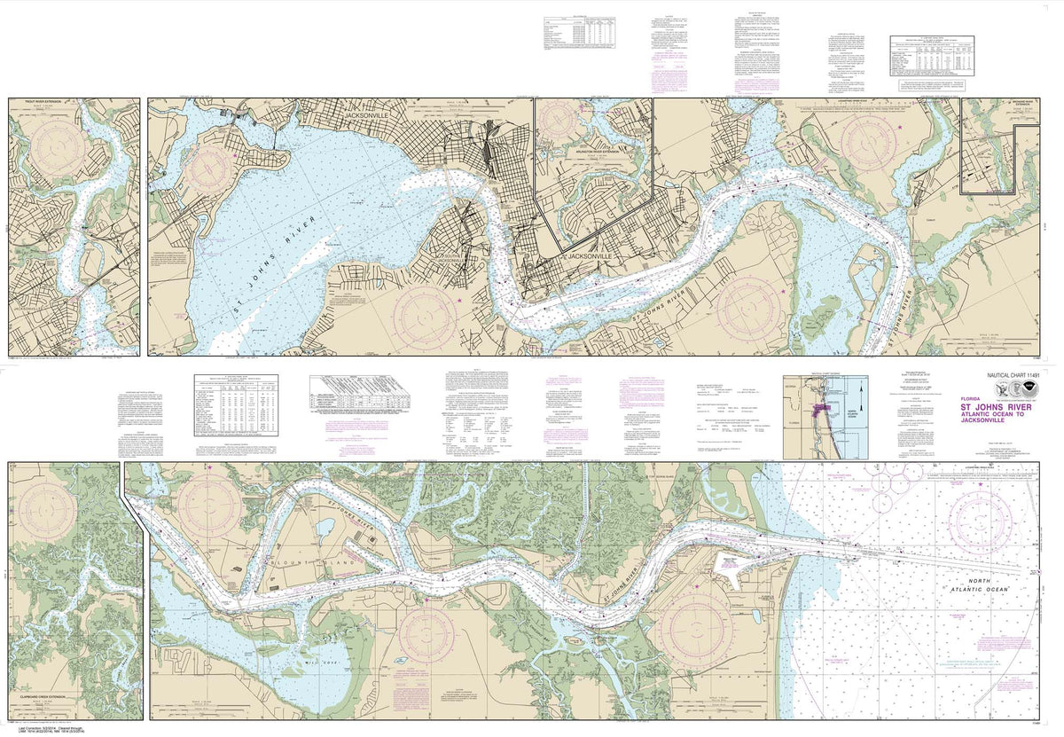

HISTORICAL NOAA Chart 11491: St. Johns River-Atlantic Ocean to Jacksonville


HISTORICAL NOAA Chart 11492: St. John's River Jacksonville to Racy Point


NOAA Chart 11495: St. Johns River Dunns Creek to Lake Dexter


NOAA Chart 11498: St. Johns River Lake Dexter to Lake Harney


NOAA Chart 11502: Doboy Sound to Fernadina


NOAA Chart 11503: St. Marys Entrance Cumberland Sound and Kings Bay


NOAA Chart 11504: St. Andrew Sound and Satilla River


NOAA Chart 11505: Savannah River Approach


NOAA Chart 11506: St. Simons Sound: Brunswick Harbor and Turtle River


HISTORICAL NOAA Chart 11507: Intracoastal Waterway Beaufort River to St. Simons Sound


NOAA Chart 11509: Tybee Island to Doboy Sound


NOAA Chart 11510: Sapelo and Doboy Sounds


NOAA Chart 11511: Ossabaw and St. Catherines Sounds


NOAA Chart 11512: Savannah River and Wassaw Sound


NOAA Chart 11513: St. Helena Sound to Savannah River


HISTORICAL NOAA Chart 11514: Savannah River Savannah to Brier Creek


NOAA Chart 11515: Savannah River Brier Creek to Augusta


NOAA Chart 11516: Port Royal Sound and Inland Passages
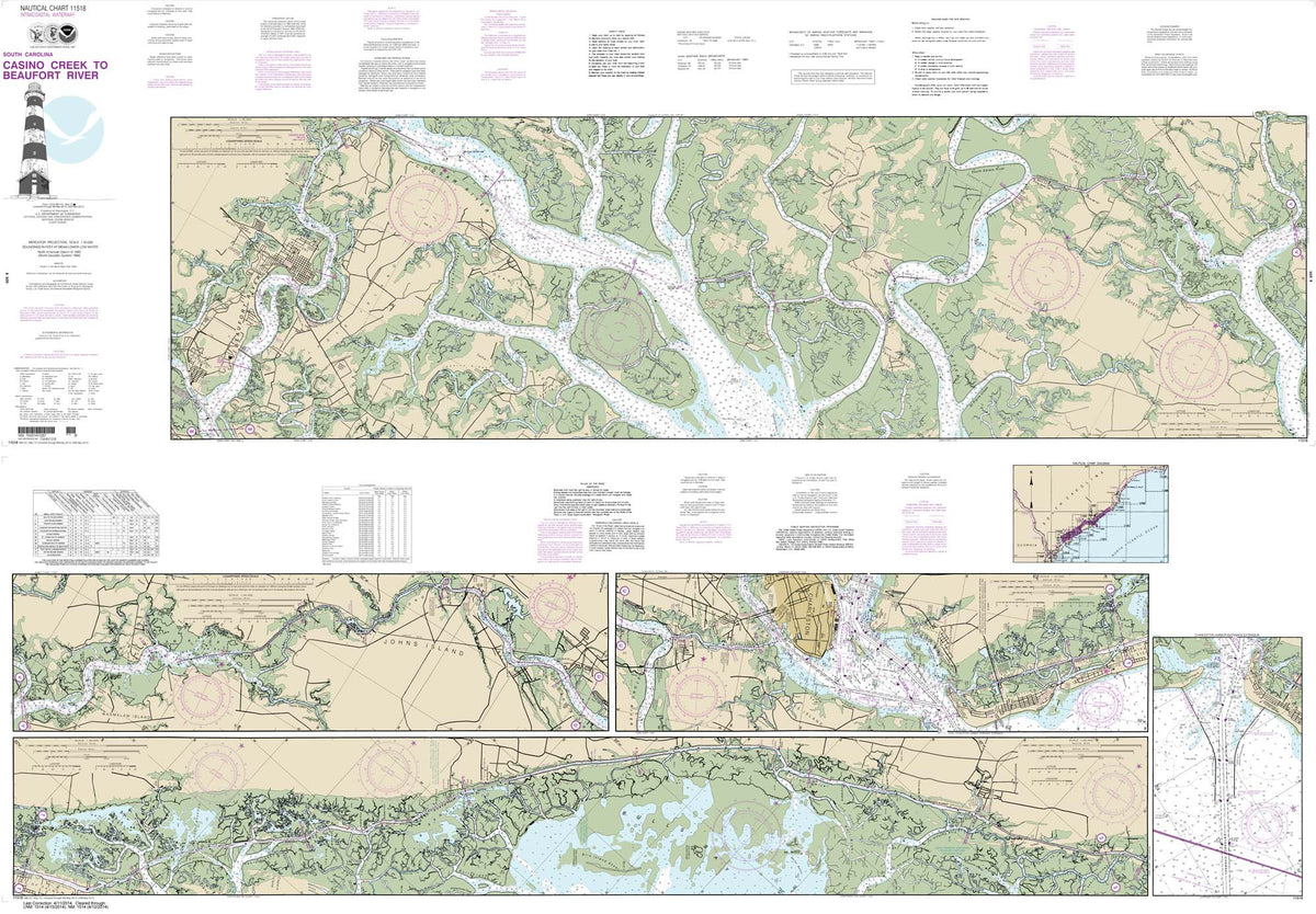

HISTORICAL NOAA Chart 11518: Intracoastal Waterway Casino Creek to Beaufort River


NOAA Chart 11519: Parts of Coosaw and Broad Rivers


NOAA Chart 11521: Charleston Harbor and Approaches


NOAA Chart 11522: Stono and North Edisto Rivers


NOAA Chart 11526: Wando River Upper Part


NOAA Chart 11527: Cooper River Above Goose Creek


NOAA Chart 11531: Winyah Bay to Bulls Bay


HISTORICAL NOAA Chart 11534: Intracoastal Waterway Myrtle Grove Sound and Cape Fear River to Casino Creek


NOAA Chart 11535: Little River lnlet to Winyah Bay Entrance


NOAA Chart 11536: Approaches to Cape Fear River


