



Best Sellers
Our best-selling charts, books and guides right now.
Our best-selling charts, books and guides right now.


FAA Chart: Enroute Low Altitude L 11/12

Big Foot and Little Foot (Book #1) - Book

Sneed B. Collard III's Most Fun Book Ever About Lizards - Book

Costa Rica Pacific Coast Marine Wildlife Guide - Folding Pocket Guide

Birds of the West: An Artist's Guide - Book


Hadibu Hyena's Horrible Hiccups - Book


NOAA Chart 18680: Point Sur to San Francisco

A Higher Call: An Incredible True Story of Combat and Chivalry in the War-Torn Skies of World War II - Book

NGA Chart 28049: Approaches to Puerto Limon and Bahia de Moin

The Pacific Crest Trail: A Hiker's Companion - Book


NOAA Chart 18433: Haro-Strait-Middle Bank to Stuart Island

Land Mammals of the Northeast - Folding Guide

NGA Chart 29104: King George Island to Clarence Island

FAA Chart: Enroute Low Altitude FULL SET

Explorer's Guide 50 Hikes Around Anchorage 2ND ED. - Book


Florida Trees & Wildflowers - Folding Pocket Guide


NOAA Chart 12318: Little Egg Inlet to Hereford Inlet;Absecon Inlet

CHS Chart 7832: Eglington Island to Cape Kellett

Ocean Emporium: A Compilation of Creatures - Book

CHS Chart 3892: Masset Harbour and/et Naden Harbour

Passages: Cape Horn and Beyond - Sailing through life’s changing currents - Book

CHS Chart 7980: Byan Martin Channel to/au Maclean Strait

Growing Wild Mushrooms: A Complete Guide to Cultivating Edible and Hallucinogenic Mushrooms 2nd Edition - Book

The Craft of Wargaming: A Detailed Planning Guide for Defense Planners and Analysts - Book


NOAA Chart 12346: Hudson River Yonkers to Piermont

CHS Chart 7738: Simpson Strait to/à Storis Passage

Bike for Life: How to Ride to 100--and Beyond, revised edition - Book

Stretch to the Sun: From a Tiny Sprout to the Tallest Tree on Earth - Book

Nocturnalia: Nature In The Western Night - Book


NOAA Chart 12277: Chesapeake and Delaware Canal

My First Seashores Nature Activity Book - Book

Nature Anatomy: The Curious Parts and Pieces of the Natural World - Book

CHS Chart 7121: Cape Mills to/à Cape Rammelsberg

12" Brass Bell w/ White Monkey's Fist Lanyard #12000

CHS Chart 7521: Prince of Wales Strait, Southern Portion/ Partie Sud

Flutes of Fire: An Introduction to Native California Languages Revised and Updated - Book

Mickey Mouse and His Spaceship (Disney: Mickey: Mouse) - Book


FAA Chart: VFR Sectional JUNEAU/WHITEHORSE


Nature Activity Book for Little Ones - Book

FAA Chart: North Pacific Route Chart Southeast FLAT

Cruising Atlas for Northwest Waters 2019 Edition - Book

O Is for Oregon: Written by Kids for Kids - Book

CHS Chart 7465: Frustration Bay and Approaches

Bigfoot Bedtime Stories: Tall Tales for All Ages - Book

Boatbuilding on Mount Desert Island - Book

CHS Chart 7184: Broughton Island and Approaches

Belize Field Guide: Sport Fish - Laminated Card

CHS Chart 3960: Approaches to/Approches à Portland Inlet

Panama Tropical Flowers - Folding Pocket Guide


NOAA Chart 12221: Chesapeake Bay Entrance

CHS Chart 3552: Seymour Inlet and/et Belize Inlet

Lonely Planet Kids America's National Parks - Activity Book

Jerky Everything: Foolproof and Flavorful Recipes for Beef, Pork, Poultry, Game, Fish, Fruit, and Even Vegetables - Book

CHS Chart 3647: Port San Juan and/et Nitinat Narrows


NOAA Chart 18529: Willamette River Walnut Eddy To Newburg

A Sailor, A Chicken, An Incredible Voyage: The Seafaring Adventures of Guirec and Monique - Book


Hawaii Trees & Wildflowers - Folding Pocket Guide


NOAA Chart 12366: Long Island Sound and East River Hempstead Harbor to Tallman Island


NOAA Chart 11526: Wando River Upper Part


Northwest Field Guide - Folding Pocket Guide

CHS Chart 7620: Demarcation Bay to/à Liverpool Bay

DK Readers L2: Slinky, Scaly Snakes - Book

CHS Chart 7793: Bathurst Inlet - Southern Portion/Partie sud

PUB. 200 Sailing Directions Planning Guide: Antarctica (CURRENT EDITION) - Book

NGA Chart 28042: Entrance to Laguna de Chiriqui and Chiriqui Grande

Bull Canyon: A Boat builder, a Writer and other Wildlife - Paperback Book

NGA Chart 28153: Coxen Hole and French Harbor


NOAA Chart 18772: Approaches to San Diego Bay

NGA Chart 29101: Deception I to King George I


NOAA Chart 18553: FRANKLIN D. ROOSEVELT LAKE Northern part


NOAA Chart 12345: Hudson River George Washington Bridge to Yonkers

CHS Chart 3686: Approaches to/Approches à Winter Harbour

Wildflowers of the Northwest Playing Cards

FAA Chart: Enroute Low Altitude EAST SET (11 CHARTS)

The Down and Dirty Guide to Camping with Kids: How to Plan Memorable Family Adventures and Connect Kids to Nature - Book

CHS Chart 3984: Principe Channel Southern Portion/Partie Sud

The Monster Detector (Big Foot and Little Foot #2) - Book

Shells of Florida’s Atlantic Coast - Folding Guide


NOAA Chart 18620: Point Arena to Trinidad Head;Rockport Landing;Shelter Cove

Sailing Fundamentals, revised & updated edition - Book

Octopuses!: Strange and Wonderful - Book

Care and Feeding of Sailing Crew 4th Ed. - Book


NOAA Chart 12244: Pamunkey And Mattaponi Rivers

Historical Chart: Trinidad Harbor 1874 (25 x 21)

Seashore Wildlife Nature Activity Book (Grades 3-5) - Book


California Trees & Wildflowers - Folding Pocket Guide


NOAA Chart 12274: Head of Chesapeake Bay

CHS Chart 3936: Fitz Hugh Sound to/à Lama Passage


NOAA Chart 18765: Approaches to San Diego Bay;Mission Bay

Complete Idiot's Guide to Smoking Foods - Book

NGA Chart 27161: Cayo Miguel to Cayo Blanco

Cruising Conversations with A Daring Duo! - Book

Dinosaurs: The Grand Tour 2nd Edition - Book

Brilliant Beacons: A History of the American Lighthouse PAPERBACK - Book

The Craft of Wargaming: A Detailed Planning Guide for Defense Planners and Analysts - Book

CHS Chart 7737: Storis Passage to/à Requisite Channel

The Grateful Dead and Philosophy: Getting High Minded about Love and Haight - Book

CHS Chart 3825: Cape St. James to/à Houston Stewart Channel

FAA Chart: North Pacific Route Chart Composite FLAT


NOAA Chart 18667: Sacramento River Fourmile Bend To Colusa

Everything You Need to Know About Snakes - Book

Navigation Lights and Shapes Card - Book


NOAA Chart 12216: Cape Henlopen to Indian River Inlet;Breakwater Harbor

Seashells & Beachcombing for Kids - Book


NOAA Chart 11545: Beaufort Inlet and Part of Core Sound;Lookout Bight

CHS Chart 7520: Prince of Wales Strait, Northern Portion/ Partie Nord


Amazing Rivers: 100+ Waterways That Will Boggle Your Mind - Book

CHS Chart 7430: Repulse Bay Harbours Islands to/à Talun Bay


Never Pat a Bear: A Book About Signs - Book

Caribbean Birds/Aves Caribenas: A Folding Pocket Guide to Familiar Species/Una Guia Plegable Portatil de Especies Conocidas - Book

CHS Chart 7792: Bathurst Inlet - Central Portion

CHS Chart 7954: Cape Stallworth to Cape Discovery

NGA Chart 28041: Approaches to Bocas del toro and Laguna Chiriqui


NOAA Chart 18764: San Clemente Island Pyramid Cove and approaches

National Geographic Road Atlas 2027: National Parks Edition - Book

Mexico: Caribbean Sport Fish - Laminated Card

NGA Chart 28151: Approaches to Puerto Castilla

CHS Chart 7103: Approaches to/Approches à Brevoort Harbour

San Juan Islands Cruising Atlas REVISED 2018 ED. - Book


Kew Imaginarium: Magical Mushroom Paradise: Calming Creative Colouring - Book

Farm Anatomy Sticker Book: A Julia Rothman Creation - Book

California Coast Field Guide: Rockfish - Laminated Card

We the Sea Turtles: A Collection of Island Stories - Book
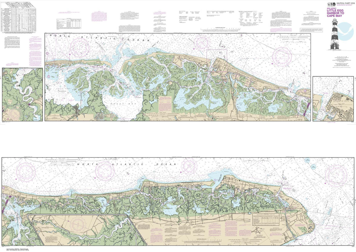

HISTORICAL NOAA Chart 12316: Intracoastal Waterway Little Egg Harbor to Cape May;Atlantic City


HISTORICAL NOAA Chart 12343: Hudson River New York to Wappinger Creek

Charlie Marlowe, Bigfoot Investigator - Book

Constellation Finder: A guide to patterns in the night sky with star stories from around the world - Book

Fish-n-Map: Strait of Georgia, Vancouver & Nanaimo to Courtenay & Powell River

The Squatchicorns (Big Foot and Little Foot #3) - Book

The Channel Islands of California – A Cruising Guide - Book

The Eye of the Whale: A Rescue Story - Book


NOAA Chart 18551: FRANKLIN D. ROOSEVELT LAKE Southern part


Animorphia: An Extreme Coloring and Search Challenge - Book

Take-Along Guide: Trees, Leaves & Bark - Book


FAA Chart: High Altitude Enroute H 11/12


NOAA Chart 18763: San Clemente lsland northern part;Wison Cove


Minerals and Rocks: A Beginner's Guide - Book


NOAA Chart 12243: York River Yorktown to West Point

FAA Chart: North Pacific Route Chart Northwest FLAT

CHS Chart 3890: Approaches to/Approches à Skidegate Inlet

CHS Chart 4117: Saint John Harbour and Approaches / et les approches


NOAA Chart 12365: South Shore of Long Island Sound Oyster and Huntington Bays


Storytelling for Sailors Video Seminar (USB Drive or Streaming Video)


